Trip Dashboard
Background
I spend a lot of time in Southern Utah. I went to college in Orem, Utah, just a 3 hour drive from each of Utah's five national parks. Though I'm out of state now, I still go back regularly for road trips to hike and camp.
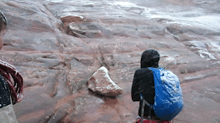
When I'm planning a trip to see the outdoors in Utah, there's always a potential logistical challenges due to bad weather. In fact, being blindsided by bad weather got me stranded on a cliff a few years ago on a climbing trip:
As I've sinced learned, snow can create dangerous conditions for hiking, clouds can obscure the nightly show of stars and galaxies, and rain can make dirt roads impassable for more obscure locations. I usually find myself checking weather forecasts and traffic cameras several times a day in the week leading up to my travel — often for multiple locations that may be chained together for a single trip. This app consolidates all the information that I would regularly be checking — cloud coverage, precipitation predictions, park entrance traffic, and road cameras — helping me to either anticipate poor conditions and make changes or gain a peace of mind about my plans.
Traffic camera API
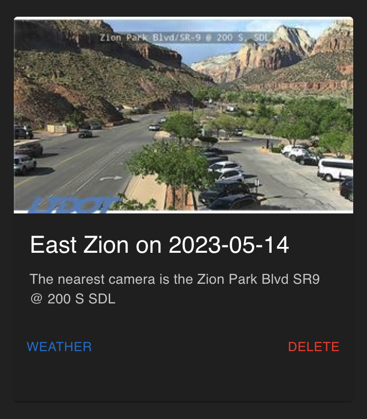
Prone to bad driving weather, the State of Utah runs hundreds of road condition cameras, streaming them live 24/7 on the DOT website. What I wanted to do with this app was give the user the ability to populate a dashboard with locations, each one with an associated card comprising a live view of the closest roads. Unfortunately, there's no Utah Department of Transportation API that'll let a user get the URL of the camera closest to a given location, so I made one myself.
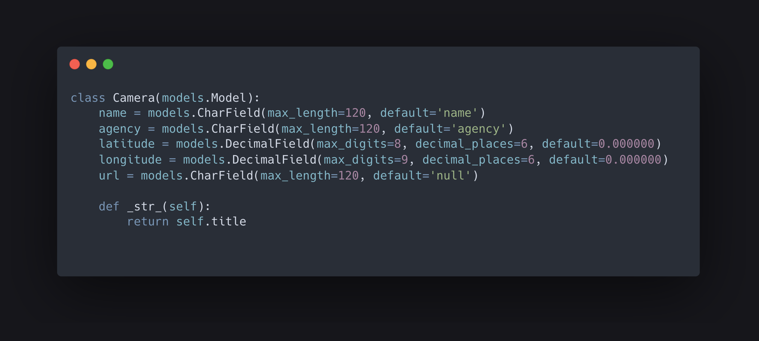
First, I needed to manually add cameras — with their coordinates, live stream URL, and a description — to my database. This was pretty tedious, and I needed to add enough to have decent coverage across the southern parts of the state. (This was my database model:)
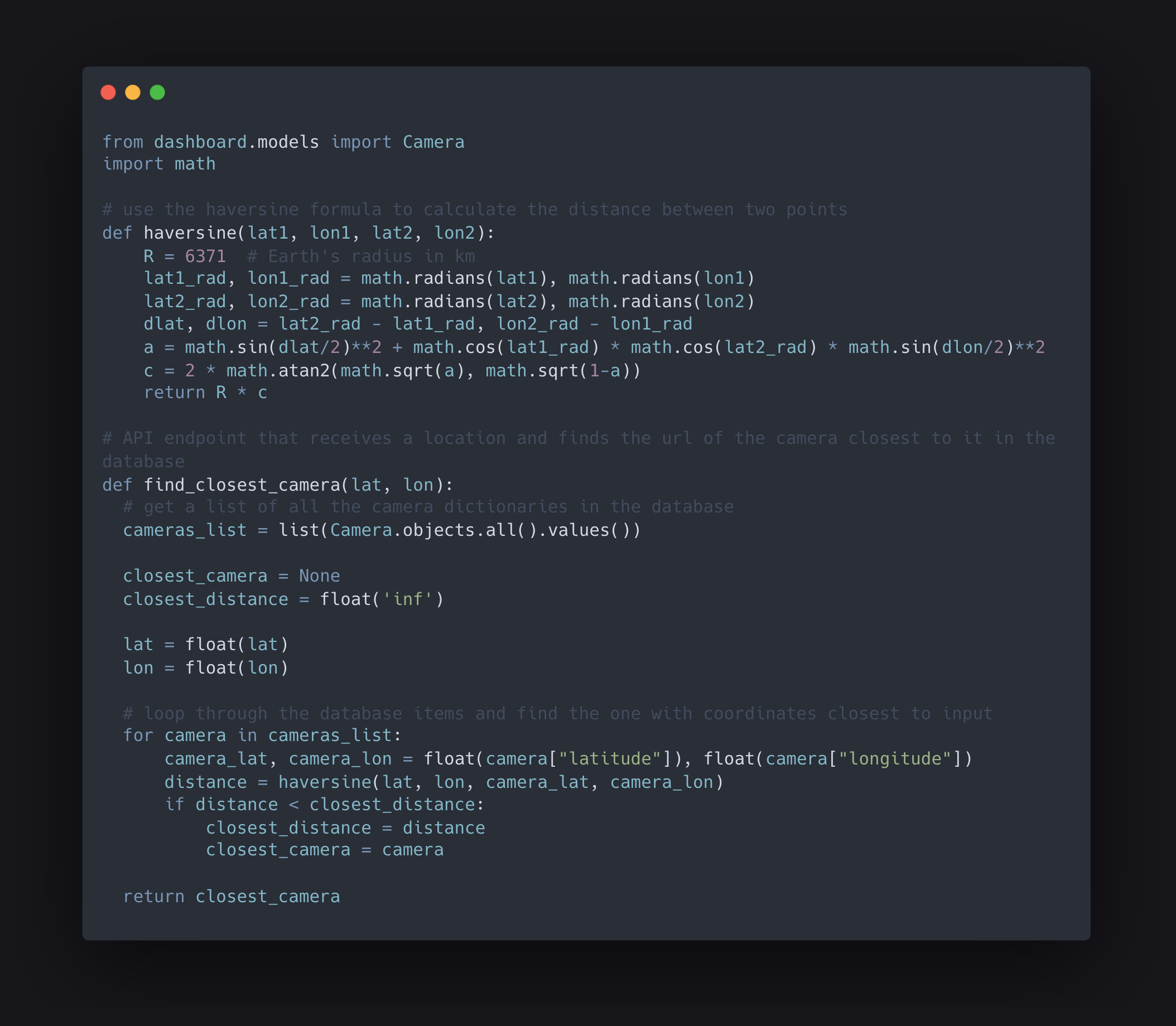
Then, with my database full of the information I needed, I was able to write a script that matches an input location with the camera closest to it.
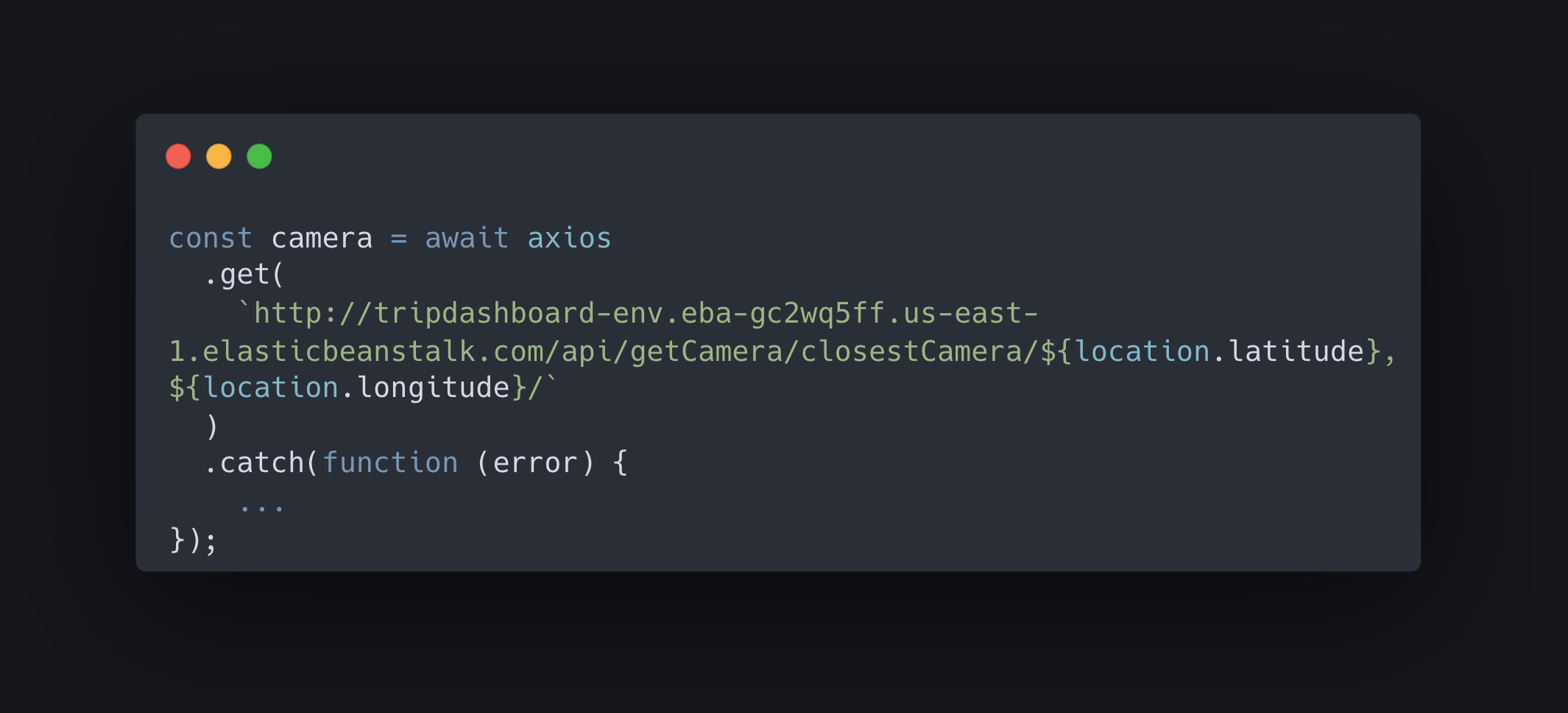
After setting the routes up in Django, I was able to send back a JSON object whenever my front-end asked what the closest camera was to a location that the user inputted.
The result of adding a trip to the dashboard is a nice little card with a live view of the road conditions around where I'll (hopefully) soon be going!
You can see the app deployed using AWS here and take a look at the source code for the project here.
Deployment and CI/CD
Write-up coming soon!